Task 5 of the Adaptation of the South East Drainage System to a Changing Climate project focused on developing two key outputs: the Groundwater, Ecology, Surface water and Wetland Assessment Tool (GESWAT) and a comprehensive and accompanying Data Dictionary.
Designed to improve access and understanding of the environmental data, GESWAT is a Geographic Information System (GIS) tool that brings together a wide range of datasets relating to wetlands, groundwater, surface water and ecological values across South Australia’s South East region. It enables users to visualise and analyse spatial data, supporting more informed decision-making.
Task 5 focused on documenting the diverse data products generated by the other project tasks, alongside relevant existing datasets that serve as the foundational inputs for GESWAT – ensuring their clarity, accessibility, and longevity.
The Data Dictionary serves as a comprehensive reference guide to the data within GESWAT. It documents both project -generated and existing datasets, ranging from administrative layers, such as, study areas and cadastral boundaries, to more detailed datasets on wetlands, ecology, hydrology, and groundwater. For example, users can explore detailed information on the South Australian Wetland Inventory Database, gain insights into wetland ecological values, and delve into complex models predicting hydrological changes due to climate change, including wetland inundation extent and frequency.
A key focus of Task 5 was to provide clear instructions for using GESWAT across different GIS platforms. Recognising the evolving landscape of GIS software, the Data Dictionary offers detailed guidance for both ArcGIS Pro and Arc Map. This is particularly timely, as support for ArcGIS Desktop (including ArcMap) is scheduled to end on 1 March 2026. The dictionary outlines key differences between the two versions and provides step-by-step instructions for opening projects, accessing geoprocessing tools, and creating custom models in ArcGIS Pro, helping users navigate the transition.
Together, GESWAT and the Data Dictionary offer a valuable foundation for ongoing environmental management and knowledge-sharing in the region.
Diving Deeper into GESWAT’s Data
Beyond the administrative and operational information, the Data Dictionary categorises and describes the rich thematic layers within GESWAT. This includes critical information on drainage infrastructure, such as drains, water courses, and water bodies.
For ecological data, users can access detailed records on listed flora and fauna, vegetation mapping, and Species of National Environmental Significance. The dictionary also includes information on water allocations and use, economic data relevant to agricultural land, and a comprehensive hydrology section covering surface water analysis and water balance modelling.
The groundwater section is particularly detailed, including hydrographs, salinographs, long-term groundwater level trends and average annual groundwater recharge estimates. Complementing this is a section on Airborne Electromagnetic Surveys, which provides conductivity-depth profiles essential for understanding subsurface conditions.
Additional datasets on soils (including flooding and waterlogging susceptibility), conservation areasand Native Title. further enriches the dataset. Aerial imagery and digital elevation models are also included to provide essential spatial context.
A forward-looking feature of the Data Dictionary is its inclusion of guidance on updating data, scripts and outputs. This ensures the information within GESWAT remains current and relevant, supporting ongoing data integrity and usability.
The delivery of GESWAT and the accompanying Data Dictionary, developed through Task 5, marks a significant step forward in the management of environmental data in the South East. By providing a clear, comprehensive, and user-friendly resource, these tools will help users get the most out of the available data – contributing to more effective environmental management and a better understanding of the region’s natural assets.
The GESWAT tool, accompanying Data Dictionary and final project reports are expected to be released in the coming month.
The authors of Task 5 were Dennis Gonzalez (CSIRO), Adrian Werner (Flinders University), Amir Jazayeri (Flinders University), Jodie Pritchard (CSIRO), Fan Hongxiang (Flinders University), Sue Botting and Ryan Judd (Limestone Coast Landscape Board).
Citation:
Gonzalez, D., Werner, A., Jazayeri, A., Pritchard, J., Hongxiang, F., Botting, S., Judd, R. (2025) Adaptation of the South-Eastern drainage system under a changing climate – Groundwater, Ecology, Surface water and Wetland Assessment Tool (GESWAT) Spatial Data Dictionary. Goyder Institute for Water Research Technical Report Series No. 25/6 (To be released in the coming months)
Funding Statement:
This Adaptation of the SE drainage system to a changing climate project has been jointly funded by the Australian Government through the National Water Grid Authority, the Limestone Coast Landscape Board, and the South Australian Government. The project is being delivered by the Goyder Institute for Water Research partners: CSIRO, the University of South Australia, Flinders University and the University of Adelaide in collaboration with the Limestone Coast Landscape Board, South Eastern Water Conservation and Drainage Board (SEWCD Board) and the Department for Environment and Water.
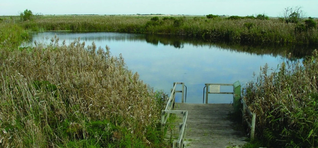
Top Image: Ewens Ponds (Photo: Limestone Coast Landscape Board)