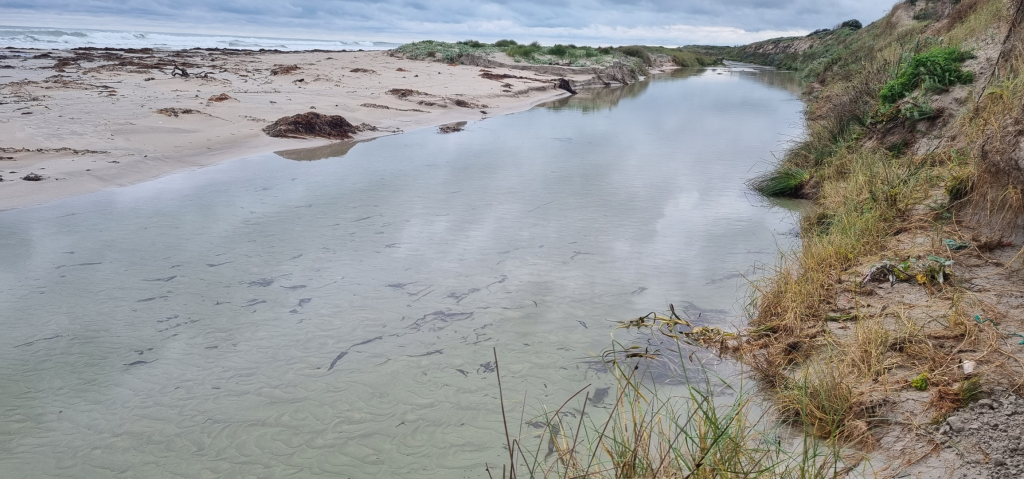
The considerable stores of fresh groundwater in the coastal aquifers of the Limestone Coast of South Australia are important resources that support the freshwater demands of various industries and are critical to a wide range of ecosystems, including iconic coastal wetlands. However, the proximity to the sea means that these aquifers need to be managed carefully to avoid seawater entering the aquifer, impacting pumping wells and freshwater ecosystems. This project attempts to develop groundwater models for estimating the extent of seawater in the Limestone Coast aquifers, and the movement of seawater both historically and in the future under a range of scenarios. Seawater moving inland in the aquifer, seawater intrusion, is the focus of Task 4 of the project “Adaptation of the South-Eastern Drainage System under a Changing Climate“—a collaboration between the Goyder Institute for Water Research and the Limestone Coast Landscape Board.
There is presently only limited understanding of the spatial extent of seawater within Limestone Coast aquifers, despite previous attempts to measure and model salinity variations within the coastal fringe. Several key management questions remain unanswered regarding the proximity of the seawater interface to critical groundwater infrastructure and coastal ecosystems, including the potential for the interface to shift landwards under existing groundwater levels. The risk of seawater intrusion occurring under various future conditions, such as sea-level rise and changes to recharge resulting from climate change, and increases in extraction (e.g., to full allocation levels), requires further investigation. The current study addresses this gap in knowledge by evaluating the current extent of seawater in Limestone Coast aquifers, and assessing the associated risks of seawater intrusion under both current and future projected groundwater stress conditions. Part of this work involved the acquisition, processing and interpretation of airborne electromagnetic (AEM) data along the coast. AEM is a geophysical technology that is highly effective at mapping the extent of the saltwater interface in coastal settings. In this study it was used to map the geometry of the interface under existing conditions, providing a baseline to constrain a new suite of numerical models (using the SEAWAT code) that have been constructed to simulate the density-dependent flow and salt transport processes that accompany seawater movements in the coastal aquifer. These models represent a significant advance over previous studies, and extend the capability of existing groundwater models of the Limestone Coast developed.
Five seawater intrusion models were created to represent different conditions across the Limestone Coast, encompassing key landmarks such as MacDonnell Bay, the southern margin of Lake Bonney, Canunda National Park, Cape Jaffa, and the Paranki Lagoon Conservation Park. The models are based on cross sections extracted from a regional-scale model (of groundwater flow, i.e., that doesn’t consider saltwater movements) developed during an earlier investigation of the South East groundwater system, also funded through the Goyder Institute for Water Research. The models were evaluated by comparing modelled salinity distributions with airborne electromagnetic survey data and available groundwater salinity measurements. This allowed for an evaluation of the models’ ability to simulate historical seawater intrusion and to build confidence in their use for assessing future risks under different groundwater extraction and climate-change scenarios.
The modelling outputs indicate that seawater has advanced landward in the Tertiary Limestone Aquifer and Tertiary Confined Sand Aquifer along the five coastal transects (cross sections) that were assessed over the 44-year simulation period (1970-2013). Seawater movements in the Tertiary Limestone Aquifer ranged from 1 m to 1,100 m, while in the Tertiary Confined Sand Aquifer, seawater appears to have shifted landward by 1 to 15 m, although in some cases, those shifts occurred in the offshore part of the aquifer.
Simulations under sea-level rise scenarios underscore the variability of likely future seawater intrusion in both the Tertiary Limestone Aquifer and Tertiary Confined Sand Aquifer. Seawater intrusion (from sea-level rise) in the Tertiary Limestone Aquifer is expected to range from 5 to 391 m, while it is expected to be 52 to 535 m in the Tertiary Confined Sand Aquifer. The scenario of increased pumping led to seawater intrusion in the Tertiary Limestone Aquifer of up to 472 m, and 1,300 m in the Tertiary Confined Sand Aquifer. Recharge-reduction simulations resulted in greater seawater intrusion than other scenarios. In the Tertiary Limestone Aquifer, seawater intrusion of up to 1,100 m was simulated, while in the Tertiary Confined Sand Aquifer, seawater intrusion of up to 3,600 m was predicted.
The development of seawater intrusion models of the type created in this project is a first for South Australia. By incorporating density-dependent flow and salinity transport processes, and by aligning model outputs with airborne electromagnetic data, these models enable a detailed representation of the coastal freshwater–seawater interface. This investigation demonstrates the value of regional-scale geophysical surveys and long-term salinity monitoring for model calibration and validation and provides direction for improving coastal aquifer monitoring to support future risk assessments. The outcomes provide critical decision-support tools for regional water managers to safeguard freshwater supplies and guide long-term planning for sustainable groundwater use in the coastal zone.
Funding Statement
This Adaptation of the SE drainage system to a changing climate project has been jointly funded by the Australian Government through the National Water Grid Authority, the Limestone Coast Landscape Board, and the South Australian Government. The project is being delivered by the Goyder Institute for Water Research partners: CSIRO, the University of South Australia, Flinders University and the University of Adelaide in collaboration with the Limestone Coast Landscape Board, South Eastern Water Conservation and Drainage Board (SEWCD Board) and the Department for Environment and Water.


