The management of groundwater and wetland ecosystems in the South East of South Australia requires decision-support tools in the form of computer models. This is the focus of Task 3 led by Professor Adrian Werner at Flinders University for the project “Adaptation of the South-Eastern Drainage System under a Changing Climate“ – a collaboration between the Goyder Institute for Water Research and the Limestone Coast Landscape Board. The models are intended to support decisions about the restoration and long-term management of Bool Lagoon and a proposed wetland near Eight Mile Creek (Karst Springs Restoration site). The models developed in Task 3 are designed to evaluate the effectiveness of various intervention strategies to enhance ecosystem health, with a particular focus on improving environmental water availability. Given the critical role of interactions between surface water and underlying aquifers for the wetlands of the study area, the numerical models have been created to simulate both surface water and groundwater flow and interdependencies, which is an advance on traditional models of either groundwater or surface water.
There is currently limited understanding of wetland–aquifer interactions in Bool Lagoon, and several key management questions remain unanswered—particularly regarding the potential for engineering interventions to expand inundated areas and improve ecosystem health through modified water management practices. Additionally, the condition of wetlands under future scenarios—including changes in inflows and reduced rainfall due to climate change—requires further investigation.
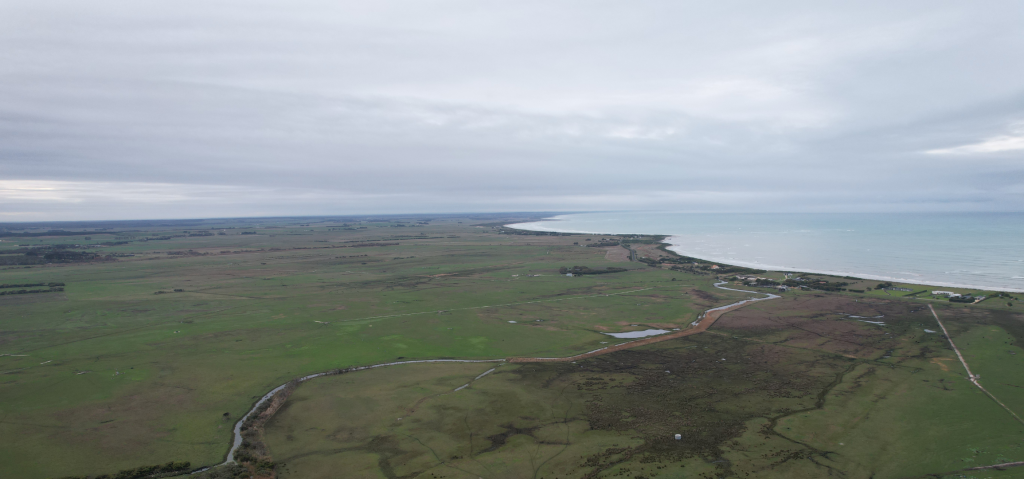
Sub-models of the two target areas were extracted from regional-scale models developed by the Department for Environment and Water. Several modifications were applied to simulate wetlands, including the addition of explicit “lakes” that grow and shrink in the model in response to the inputs and outputs to the simulated wetlands. The match between the numerical model and field data (satellite imagery of the inundated wetland extent, groundwater and surface water levels, and gauged measurements of outflows) was found to be reasonable for Bool Lagoon, where these data are available. This builds confidence that the wetland hydrology has been approximately reproduced by the new groundwater-surface water model of Bool Lagoon. There are limited data available to assess the surface hydrology of the Karst Springs Restoration site because the model simulates a new development where a wetland is to be re-established.
The results from scenarios related to modified wetland conditions showed that altering inflows caused only small changes in groundwater heads and surface water levels in and around Bool Lagoon. An increase in the elevation of the levee separating the Main Basin (upstream of the levee) from the downstream Central Basin (including the Western Basin) led to higher wetland water levels in the Main Basin (including Little Bool Lagoon) at the expense of lower water levels in the Central Basin after inflow events. The water levels of Hacks Lagoon, upstream of the Main Basin (including Little Bool Lagoon), also rose slightly with the increased height of the levee between the Main and Central Basins. Surprisingly, the increased levee elevation slightly enhanced wetness in the Central Basin (including the Western Basin) during dry conditions because of groundwater pathways between the different basins of Bool Lagoon.
Scenario results for the proposed wetland at the Karst Springs Restoration site showed that raising the outflow weir crest (from 2.0 m to 2.5 m above sea level) significantly increased wetland water levels, volumes, and the inundated area, whereas lowering the crest to 1.5 m above sea level limited the wetland to only a small area. Reductions in rainfall and inflows had smaller effects on the wetland extent and very limited effect on groundwater levels.
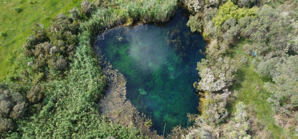
Image above: Karst spring discharge is being used to restore the surrounding wetland ecosystem.
The development of wetland-aquifer interaction models represents the first of their kind for South Australia. By including the surface water processes that affect wetland extent into the models, new data sources such as Water Observations from Space, and other measurements of wetland dynamics could be integrated into the model analysis. The investigation highlights the value of long-term measurements of Bool Lagoon and its inputs and outputs and offers guidance on improvements to the monitoring of this important ecosystem to allow for future model enhancements.
Publication of the project reports is expected in the coming months.
This Adaptation of the SE drainage system to a changing climate project has been jointly funded by the Australian Government through the National Water Grid Authority, the Limestone Coast Landscape Board, and the South Australian Government. The project is being delivered by the Goyder Institute for Water Research partners: CSIRO, the University of South Australia, Flinders University and the University of Adelaide in collaboration with the Limestone Coast Landscape Board, South Eastern Water Conservation and Drainage Board (SEWCD Board) and the Department for Environment and Water.
Featured image credit – Lachie Farrington