Following the successful completion of the second term of the Goyder Institute as highlighted in our October e-newsletter, the research program continues to have important impacts locally and nationally. Whilst the second term research program was focussed on providing expert research and advice to inform priority water policies of the South Australian government, additional benefits are now being realised through the development of new collaborations, research projects and management products and services. These benefits are being realised across all three Impact Areas – Economic Development, Climate Action and Healthy Ecosystems Sometimes – with three examples outlined below.
Economic Development: Finding Long-term Outback Water Solutions (G-FLOWS)
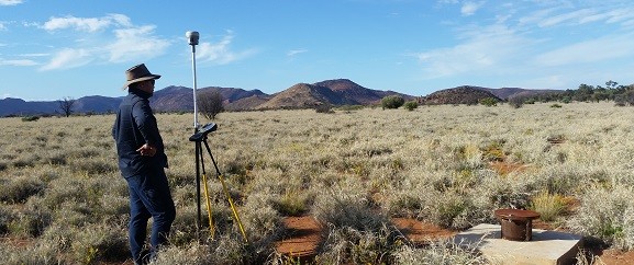
CSIRO are partnering with the South Australian Government to better understand the groundwater potential of the Braemar region using innovative technologies developed in the GFLOWS projects (stages 1, 2 and 3). The South Australian Government has identified water as a critical resource and a limiting factor in the development of some of the most prospective areas in regional South Australia. The Braemar corridor in north-east South Australia is one of these regions, being highly prospective not only for magnetite, but also for other commodities including gold, copper and uranium.
The Braemar corridor comprises a sequence of weathered ancient rocks overlain by younger sedimentary rocks. There is a potential for 20 to 40 billion tonnes of mineable deposits throughout the Braemar Iron Formation. However, supporting the development of this resource requires water, particularly to support mining and processing.
The new initiative builds on work of the GFLOWS projects and involves the development of a hydrogeological framework map, underpinned by the re-interpretation of regional and finer-scale airborne electromagnetic data which covers the areas of interest. Initial work has focused on the identification of sediment-filled palaeovalley systems which may host groundwater resources of varying quality. This will be followed up by targeted drilling and an analysis of the groundwater identified.
Climate Action: Blue Carbon research projects
Research undertaken by the two ‘Blue Carbon’ Goyder Institute projects (Salt to C and Coastal Carbon Opportunities) supported the development of the South Australian Government’s Blue Carbon Strategy. These projects are now continuing to play a foundational role in achieving some of the key objectives of the Strategy.

The two Goyder Institute projects identified the potential for coastal wetlands to store and sequester carbon across South Australia and contribute to the state’s emissions reduction targets. Important progress has recently been made in connecting blue carbon ecosystem restoration to carbon markets through the development of an accredited Emissions Reduction Fund (ERF) blue carbon methodology. This has been supported by findings of the Goyder Institute research projects, with researchers Dr Alice Jones and Associate Professor Luke Mosley (The University of Adelaide) and Professor Sabine Dittmann (Flinders University) providing expert input through a technical reference panel and carbon abatement modelling working groups. The proposed method is being progressed by the Clean Energy Regulator (CER) and will enable carbon crediting projects for Blue Carbon to go ahead in Australia based on activities that reintroduce tidal flows.
The projects of the Goyder Institute are also underpinning further scientific investigations needed to realise blue carbon opportunities in South Australia. Work is currently underway through Green Adelaide’s Blue Carbon Futures Fund to map blue carbon potential; understand wetland vegetation dynamics after reintroduction of tidal flow; quantify blue carbon opportunities through tidal reconnection; explore the carbon storage potential of coastal sedgelands; and analyse blue carbon changes linked to seagrass recovery in the Port River. Other work is being advanced by the Eyre Peninsula Landscape Board with support from the Coast Protection Board to investigate fine scale drivers of blue carbon variability in Eyre Peninsula saltmarsh and mangroves1, and by SA Water to monitoring seagrass recovery using drones (with the University of Adelaide’s Unmanned Research Aircraft Facility).
Healthy Ecosystems: Ecological Connectivity of the River Murray
The Ecological Connectivity of the River Murray project developed a new model to inform the operations of new floodplain infrastructure to balance the environmental water needs of the River Murray and its floodplains and mitigate water quality risks. The new infrastructures are Supply Projects of the Murray-Darling Basin Plan, that aim to improve ways to manage the Basin’s rivers to more efficiently deliver water for the environment. With a number of Supply Projects across the Basin, outputs of the Goyder Institute project are now being used interstate to inform river operations across the Basin.
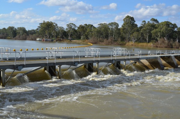
The dissolved oxygen dynamics task within the Ecological Connectivity project (Dr Matt Gibbs and Todd Wallace, The University of Adelaide) extended the Dissolved Oxygen – Dissolved Organic Carbon model developed by the Department for Environment and Water to assess water quality risks associated with different infrastructure operation scenarios. This was achieved through an extensive data collection campaign and novel applications of the model to inform cumulative operations of infrastructure along the River Murray. This is being used in South Australia to maximise benefits from increasing inundation of the floodplains without increasing the risk of poor water quality events. The tool has recently been adopted for upstream sites, with work currently being undertaken by the NSW Department of Planning, Industry and Environment and by the Victorian Murray Floodplain Restoration Project to inform proposed increases in floodplain inundation at both the site and whole of reach scales.
***
Notes:
- Described further in the following articles:
