The Goyder Institute for Water Research is pleased to announce that it is partnering with the Limestone Coast Landscape Board for a new 2.5 year research project to help build resilience of agriculture and groundwater dependant ecosystems in the Limestone Coast region of South Australia.

The Limestone Coast (LC) region contains a diverse and productive agricultural sector that supports the local economy and a number of important wetlands regionally, nationally and internationally. These values are underpinned by the availability of good quality water, but demand for water is outstripping supply. Future climate change and ongoing increases in water demand are expected to put further pressure on water resources and the values they underpin.
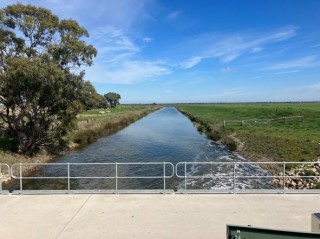
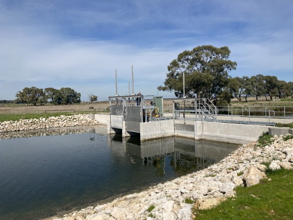
With this in mind, the LC Landscape Board is exploring whether there are opportunities to manage water from the extensive drainage network in the region to address risks to primary industries and groundwater dependent ecosystems (GDEs). An important component of this is the establishment of the new research project with the Goyder Institute: Adaptation of the South-Eastern drainage system under a changing climate.
Penny Shulz, the Chair of the LC Landscape Board, was delighted in establishing the project with the Goyder Institute, saying “the project will provide us with critical knowledge to identify whether there are options to manage the drainage network differently to help manage risks to groundwater dependent ecosystems and primary industries. This will be an important step in our endeavours to enhance cultural, economic, environmental and social values of the Limestone Coast region through innovative management of our precious water resources”.
Ms Shulz also recognised “the ability to ‘tap into’ leading and diverse expertise from across the Goyder Institute’s partnership will be critical given the complexity of the problem”. A collaborative, transdisciplinary research team from CSIRO, Flinders University, the University of South Australia and The University of Adelaide will collaboratively deliver the research. Task leaders for the project are Dr Bethany Cooper, a Senior Research Fellow in the Centre for Markets, Values and Inclusion of the University of South Australia; Dr Matt Gibbs, a Senior Research Scientist (hydrologist) in CSIRO’s Water Resource Assessment team; Professor Adrian Werner, a renowned expert in groundwater modelling at Flinders University; and Dr Tim Munday, the Research Director of CSIRO’s Deep Earth Imaging Future Science Platform.
The project will identify opportunities to redirect and retain drainage water in the landscape to mitigate risks and build resilience of primary industries and groundwater dependent ecosystems. Specifically, it will assess the potential to manage the drainage water to locally recharge groundwater to provide additional water for meeting the environmental water requirements of key wetlands, navigate projected climate change, and mitigate the risk of seawater intrusion. This will be achieved through five integrated tasks between now and early 2025, including:
- Quantifying the value of different water uses and future demands, which will develop an understanding of the value of different water uses in the Limestone Coast.
- Current and future water availability, which will quantify water availability across the region for historic and future climates.
- Groundwater and wetland modelling, which will investigate options to improve water availability to groundwater dependant ecosystems.
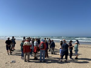
The project will ‘kick-off’ with an airborne electromagnetic (AEM) survey along the south coast of the Limestone Coast in October 2022. This will form part of a fourth task (Seawater intrusion risk), which will develop an understanding of the risk to irrigated agriculture posed by sea level rise and seawater intrusion into groundwater.
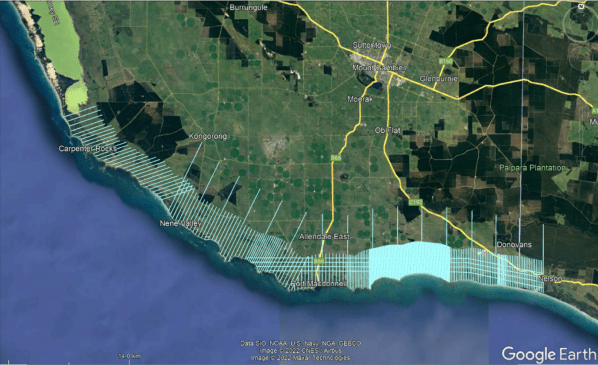
All of these tasks will feed into a final task – Landscape feasibility analysis – which will develop a GIS-based prioritisation tool to support the LC Landscape Board to identify priority locations for management intervention to improve wetland health and to prevent seawater intrusion within the coastal aquifers.
The research will build on previous work of the Goyder Institute in the Limestone Coast, including the recent South East Science Review project and previous projects; South East Regional Water Balance, Catchment and drainage network modelling for the Upper South East, and Developing ecological response models for wetlands of the South East. This was highlighted by Goyder Institute Director, Dr Kane Aldridge who said “It’s fabulous to be able to continue our important partnership with the Limestone Coast Landscape Board by building on our previous research that has provided solid foundational knowledge to allow us to tackle some more specific management questions for the region and support them addressing one of their major challenges in future water availability”.
The project is part of the LC Landscape Board’s broader water resource management approach of “Making every drop count”, which has funding support through the National Water Grid Authority, the State Government’s Landscape Priorities Fund, and the LC Landscape Board. The work will also form an important part of the Institute’s priority Impact Areas of Water for Agriculture and Water for the Environment of the Institute’s Strategic Plan, 2020-2023.
Please contact Daniel Pierce, Goyder Institute for Water Research, for more information about the project or the Institute’s research program.
